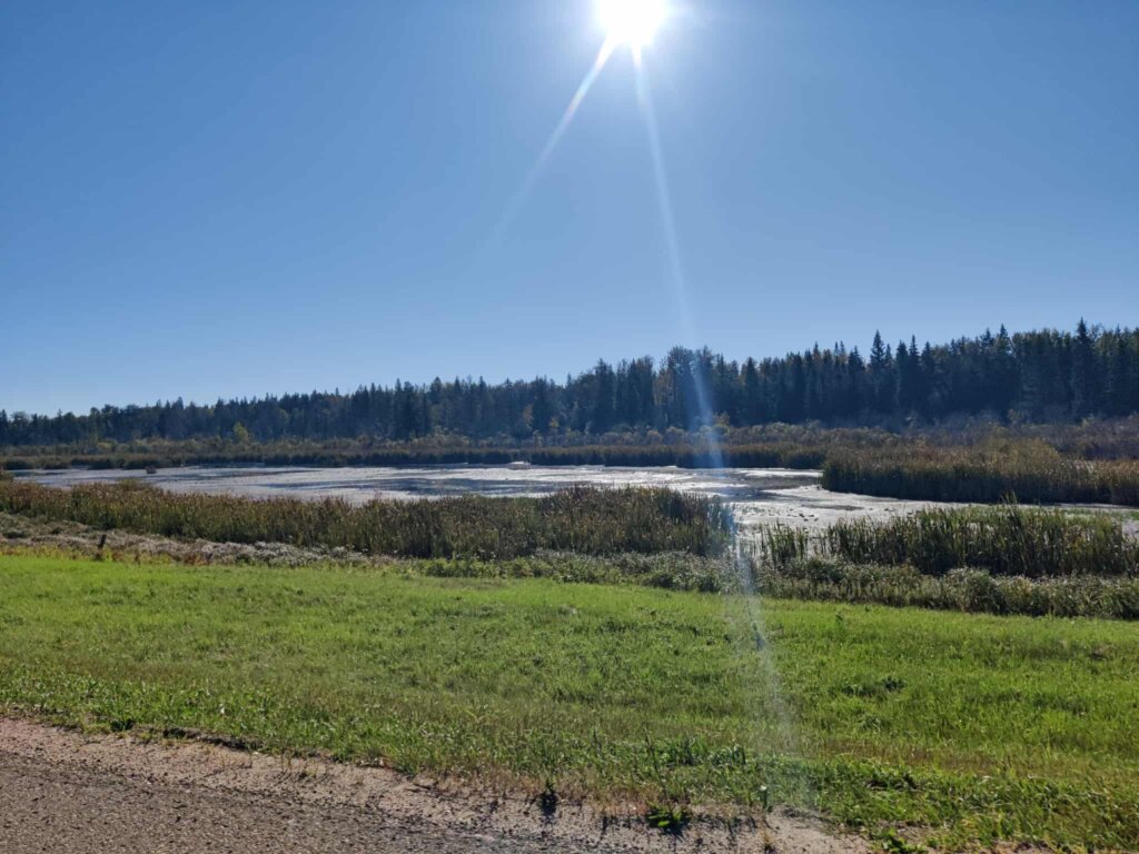
At the headwaters of the Tawatinaw River, Helliwell Lake is nestled near the community of Nestow in Westlock County, Alberta. The Dry Mixedwood subregion is dominated by aspen, White spruce, and rose plant species, creating beautiful forested areas with sandy soils. Helliwell Lake is surrounded by agriculture and wetlands, that support both humans and wildlife. Whether you’re paddling across the calm waters, hiking the nearby trails, or enjoying the wildlife viewing opportunities, there are many ways to connect and appreciate the beauty of the Tawatinaw Watershed.
Helliwell Lake is a haven for wildlife and a fantastic spot for bird enthusiasts. According to the Birds of the Tawatinaw Valley biodiversity list, over 125 species have been recorded here and in the nearby Meanook National Wildlife Area. Shorebirds and waterfowl are most common, so keep an eye out for White Pelicans, Pied-billed Grebes, and Lesser Yellowlegs. In the fall migration, large flocks of Greater White-fronted and Snow Geese gather at this lake. Summer time becomes a molting ground for puddle ducks, also known as dabbling ducks that feed in shallow water, such as Blue-winged Teal, Green-winged Teal, and Mallards. And while the birds steal the spotlight, Helliwell Lake also provides habitat for a wide range of other wildlife such as White-tailed Deer, Muskrats, and various species of Amphibians.
Have you ever wondered what’s being done to monitor and keep Helliwell Lake healthy and beautiful? That’s where the Tawatinaw Watershed Working Group, formed by the Athabasca Watershed Council, comes in. This group brings together community members who care about the Tawatinaw River and all its connected waterways, including Helliwell Lake. With Water Rangers test kits, citizen scientists gather important water quality data. Globally, the Water Rangers community has logged over 66,000 observations, helping communities understand what is really going on in their lakes and rivers. Their mission is to “equip communities with the tools and knowledge they need to understand and protect their waterways.”
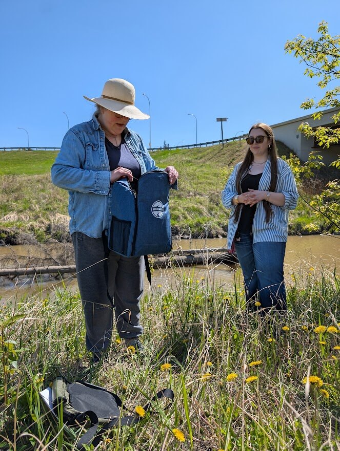
Here in the Tawatinaw Watershed, there have been 10 sites sampled already, including Helliwell Lake, which has been tested 9 times since October 2023. “Where is the sampling spot?”, you may ask. It’s right off the northwest corner of the bridge on Range Road 250! Each visit involves both chemical and physical water tests, from pH, temperature, and alkalinity, to dissolved oxygen and conductivity. These numbers can tell a story about a lake and river’s health. For example, warmer water can hint at pollution or algae blooms, while dissolved oxygen reveals how much aquatic life the system can support based on how much oxygen is present.
The most recent observation at Helliwell Lake was conducted on August 1st, 2025, where some parameters stood out. The water temperature hit 25 degrees Celsius, quite a bit higher than the average of 17.2 degrees Celsius. The most concerning parameter change was dissolved oxygen, where it dipped it 3 mg/L, well below the average of 8.1 mg/L. At that low of a level, only few fish and aquatic invertebrates can survive, affecting the biodiversity of a system.
When it comes to physical testing, there are only two simple measurements, water depth and clarity. These are great long-term indicators, as it can reveal patterns of drought or flooding in the ecosystem. Clarity is measured with a Secchi disk, which is a white and black disk that gets lowered into the water until it is out of view. This tells us how clear the water is until a certain depth.
During the most recent sampling, water depth at Helliwell Lake dropped to just 0.5 meters, compared to the average of 1.1 meters. Water clarity, however, stayed consistent with previous results of 0.5 meters.
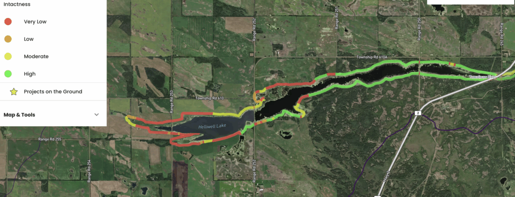
Another way that the AWC is supporting the Tawatinaw Watershed is through riparian area assessments. Riparian zones, which is the land before the water’s edge, is a critical component of an aquatic ecosystem, as they support the wildlife that call the ecosystem home, and also protect water quality by filtering runoff and stabilizes shorelines. Helliwell lake displayed 38% (7 km) of very low intactness, meaning the natural habitat is fragmented, often due to agriculture, or residential. While 46% (8 km) showed high intactness, meaning there is little to no disturbance and plenty of natural vegetation present.
So, what can we do as landowners to keep our shorelines healthy? One of the simplest steps is to let nature do the work. Leaving natural debris, like fallen leaves and branches, along the shoreline provides shelter for wildlife, supports aquatic food webs, and contributed to nutrient cycling as the material breaks down and enriches the soil and water. Larger woody debris also helps stabilize streambanks, slow erosion, and create valuable habitat for fish, aquatic invertebrates, and other wildlife. It’s also important to protect native plants; Avoid removing them whenever possible. While removing invasive species is helpful, since they tend to spread quickly and outcompete native vegetation, keeping native plants intact ensures biodiversity and long-term resilience.
Beyond vegetation, there are other ways to lighten our footprint. Low-impact development practices such as installing rain barrels, creating rain gardens, or using permeable pavement can improve water infiltration and reduce surface runoff. Limiting the use of fertilizer and pesticides near the shoreline also helps protect water quality and the vegetation that keeps riparian zones thriving. And when it comes to accessing the water, consider building a seasonal floating dock, as it provides access without damaging shoreline areas.
Since Helliwell Lake offers plenty of opportunity for recreation, we need to consider the environmental impacts that comes with the enjoyment. The use of vehicles and heavy equipment along the shorelines cause significant damage, disturbing native vegetation, increasing sedimentation, and ultimately degrading water quality. The use of watercraft such as kayaks, canoes, and boats can also spread invasive species and diseases. To prevent this, Clean, Drain, Dry practice can help prevent the spread to other waterbodies.
If you’re interested in restoring your shoreline, there are two main approaches to consider. Passive restoration allows native vegetation to regenerate naturally with minimal human interference. This low-cost method may involve simple steps such as fencing off shorelines, limiting trails, and restricting access to water, giving plants and wildlife space to recover. The other method, active restoration, takes a more hands-on approach by planting native species in degraded patches. This method accelerates restoration and helps stabilize the shoreline while enhancing biodiversity.
Next time you visit the lake, take a moment to notice how your actions affect the shoreline. Small changes, like choosing designated access points, respecting vegetation, and reducing the spread of invasive species can make a lasting impact in protecting these special spaces.
References:
Birds of the Tawatinaw Valley: https://scienceoutreach.ab.ca/events/documents/Tawatinaw%20Birds%20PDF.pdf
Water Rangers Tawatinaw Watershed Working group: https://data.waterrangers.com/datasets/tawatinaw-watershed-working-group
Tawatinaw Watershed Working Group: https://athabascawatershed.ca/tawatinaw/
Clean, Drain, Dry your gear – Government of Alberta: https://www.alberta.ca/clean-drain-dry-your-gear