Shayla Watson, Healthy Shorelines Coordinator
When people think of the Athabasca River and the issues it may be facing, they almost immediately think of the lower portion of the river, particularly in and around Fort McMurray and Fort McKay. That is not surprising considering how much industry and other activities happen in this area, which is often the subject of any media relating to the Athabasca River. I know that when I applied for an internship with the Athabasca Watershed Council (AWC) back in 2023, that region was at the front of my mind as being the more challenged area of the watershed. The last 3 years have taught me that the reality is a bit more nuanced than that.
Shortly after the AWC was formed, they prepared a ‘state of the watershed’ report (SOW report) that assessed various aspects of watershed health throughout the Athabasca basin. The 2012 SOW report (https://athabascawatershed.ca/state-of-the-watershed/) was released in four phases and is now in the process of being updated to determine how the watershed has changed over the last 14 years. These documents tend to be super long, very technical, and quite frankly, if you’re someone who doesn’t work in the water management world, they can be a bit dry. However, they are chock-full of incredibly useful information that helps guide our day-to-day work as a watershed council. One of the most useful parts of these reports is that they break down aspects of watershed health by sub-basin, which allows us to identify areas that are more impacted and could use more attention when it comes to things like restoration and conservation work, as well as education and outreach initiatives.
One of the first things I did when I started working for AWC was look through their SOW reports to get a better understanding of how the watershed was doing. I went into this report thinking “oh obviously the lower portion of the Athabasca is going to be the most impacted, and everything else is going to be peachy, you never hear about anything other than the oil sands region…”
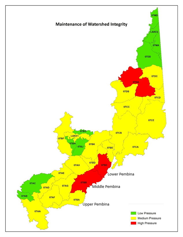
“…wait, what is that section in the middle that is classified as being under high pressure??” Turns out, it’s the middle and lower portions of the Pembina sub-basin! I was shocked, and if I’m being completely honest with you, a little ashamed (I grew up and still live in the lower Pembina area, so I can’t help but feel partially responsible, even though it’s far more complicated than that).
While compiling these SOW reports, land use and major industries in the areas were looked at, and it was realized that a lot of the impacts in that middle and lower Pembina region were associated with municipal developments and agricultural land use. This is a result of things like linear disturbances for roads and oil and gas exploration, clearing of land for fields (especially clearing of riparian areas around different water bodies), and the straightening of rivers and creeks that was done years ago by local governments (especially prevalent in the lower Pembina area), just to name a few examples of the land-use pressures in this region.
While this information is useful, it is still fairly high-level and makes it difficult to understand if there are specific areas within the Pembina sub-basin that were being impacted. For context, the middle and lower portions of the Pembina sub-basin alone span more than 10,000 km2 of land with over 2500 km of shorelines, so classifying this entire area as being under “high pressure” doesn’t exactly give us a lot of details of where the problem areas are. This is where a new initiative was born!
The Healthy Shorelines Initiative:
After realizing that there was something going on within the Pembina, AWC decided to start investing more time in this area to get a better understanding of why this area was facing higher pressure compared to the surrounding basins. With the help of dollars from the Government of Alberta’s Watershed Resiliency and Restoration Program, AWC was able to start the Healthy Shorelines Initiative!
The goal with this initiative is to improve shoreline health within the Athabasca Watershed by compiling and sharing information about watershed health, hosting workshops and education events for local communities related to improving shoreline health, and, where possible, working with local partners (i.e. landowners and municipalities) to carry out on-the-ground restoration projects. And our starting point? The Pembina, of course!
To get a better understanding of where those impacts highlighted in the SOW reports were, AWC worked with Fiera Biological Consulting to complete some riparian assessments for the Pembina River watershed. These reports used satellite imaging to assess the riparian health of the Pembina itself, as well as the riparian health of the many tributaries and lakes throughout the sub-basin. This report looked at things like the intactness of shoreline vegetation as well as natural and anthropogenic pressure to help determine which areas of the watershed would be considered a high priority for restoration and conservation projects.
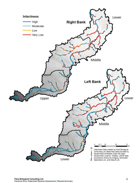
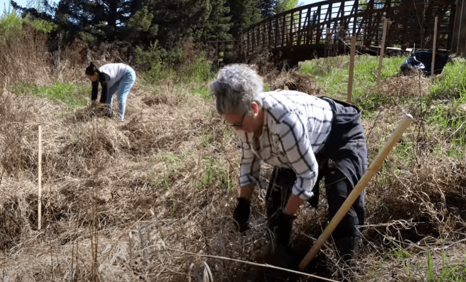
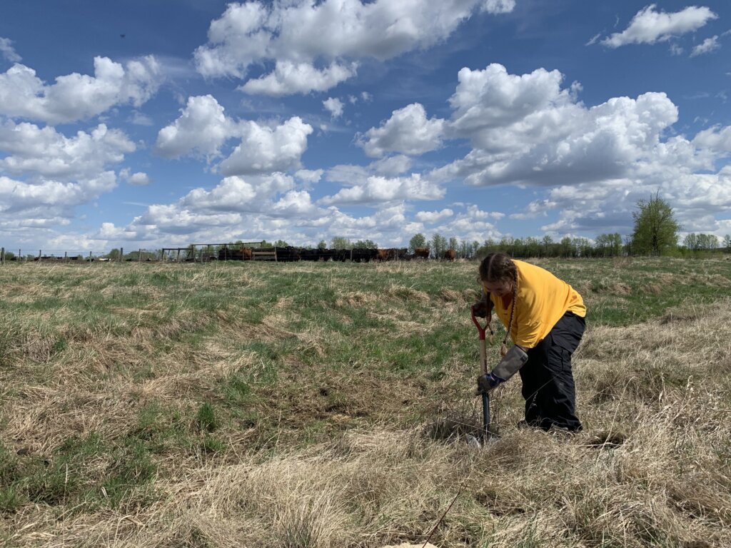
As you can see in the above map that shows shoreline intactness across the Pembina watershed, these reports give us a much more detailed understanding of where there might be some areas that could use some help. After getting these reports, AWC was able to do more targeted engagement in these areas that had lower intactness and were classified as a higher priority for restoration. The goal with this engagement was not only to educate attendees on how they can improve shoreline health, but also to find landowners or other local partners who had shorelines on their property that could be improved with some restoration work. These shoreline restoration projects could be as simple as planting some native riparian plants, like willows, dogwood and saskatoon, or they could also involve things like completing invasive species pulls or providing financial support to farmers to purchase an off-site waterer and fence their livestock out of a waterbody.
Our first restoration project with the Healthy Shorelines Initiative was completed in 2021, and since then, we have been able to restore more than 500 acres of land and have improved over 30 kilometres of riparian area!
Where we’re at now:
We are coming up on 6 years of the Healthy Shorelines Initiative now, and we still follow the same process that we used for the Pembina. Riparian assessments have now been completed for the Tawatinaw and Lower McLeod watersheds, which we followed up with engagement events to find local partners to work with, and we have now carried out restoration projects in both areas, with the hopes of completing more in the coming years! This riparian assessment data has also been uploaded to the Riparian Web Portal, which honestly deserves a blog post on its own, but I strongly encourage you to check it out.
In addition to the projects that we complete, we like to work with other local organizations to carry out restoration projects as well. One of our key partnerships within the Healthy Shorelines Initiative is with ALUS Barrhead-Westlock-Athabasca (ALUS BWA) (https://alus.ca/alus_community/barrhead-westlock-athabasca/), which is managed by Lisa Card. This partnership allows us to help ALUS BWA with projects that are around a water body, whether that’s providing advice, helping plant trees, or even helping to cost-share some projects, which allows ALUS to complete even more restoration projects. Lisa is also a huge help to us with our own work, so thank you, Lisa! This partnership has been invaluable in helping improve the shorelines within the area.
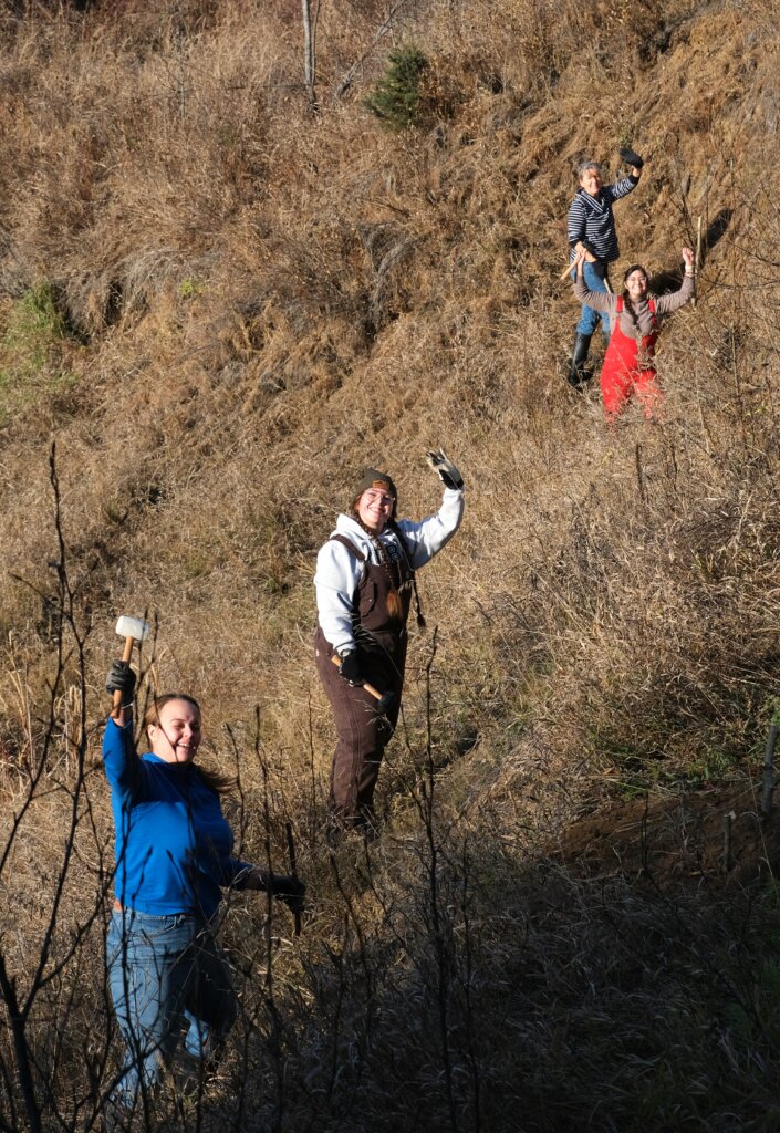
As the “Healthy Shorelines Project Coordinator,” this project is my bread and butter. Being able to work directly with landowners to help improve the health of our watershed, either by planting trees or providing financial assistance for fencing and alternative waterers, feels very full circle as someone who grew up in a farming family in the area. The days that we spend out in the field working on projects always come with fond memories as well; the stories you hear about what the river looked like 30 years ago compared to now, all the dogs, cats and cows that we get to hang out with on site, the jokes that are made in the field that only make sense if you’re there, and when a landowner invites the team in for some cold iced tea after planting trees in the hot sun?? I mean, living the dream, amiright?
Our 2026 planting season is already jam-packed with projects, but if you or someone you know would be interested in working with AWC to discuss a potential restoration project, please don’t hesitate to reach out! Even if we can’t help you directly (some projects are too big for us), we can get you in contact with organizations that can.
If you were reading this blog and thought, “gee, I wish I could see the full SOW report and riparian assessments…” Fear not! All phases of the SOW report, as well as the riparian assessments for the Pembina, Tawatinaw, and Lower McLeod watersheds, are on our website! Check them out:
Check out our SOW report: https://athabascawatershed.ca/state-of-the-watershed/
Learn even more about the Healthy Shorelines Initiative and check out the Pembina, Tawatinaw and Lower McLeod riparian assessments here: https://athabascawatershed.ca/athabasca-watershed-shorelines-initiative/